Water Reservoirs & Drought Levels in Spain
Consolidate and visualize official data from all Spanish river basin authorities and the Ministry for Ecological Transition (MITECO). Interactive maps, historical analysis, and widgets.
The app is currently available in Spanish only.
How it works
Consolidates official hydrological data across Spanish river basins into one clear interface.
Official data retrieval
Direct connection to the Automated Hydrological Information Systems (SAIH) across 16 basin authorities and MITECO mapping services to pull current volume (hm³), total capacity, and weekly trends.
Historical analysis
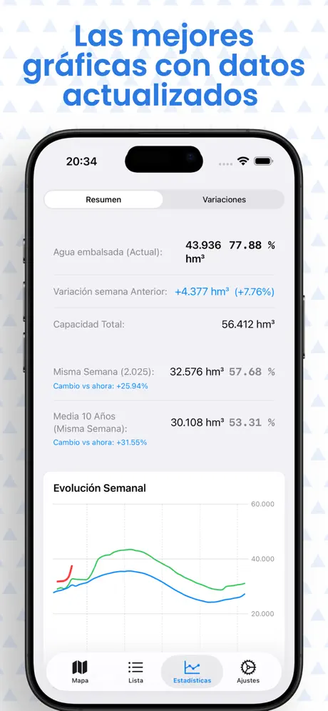
Using a local database with over 74,000 historical records, the app compares every reservoir against the same week of the previous year and calculates the 10-year historical average.
Local caching & offline mode
Queried data is cached locally on device to allow browsing recent measurements even without network coverage.
Application features
Breakdown of tools and screens implemented in the code:
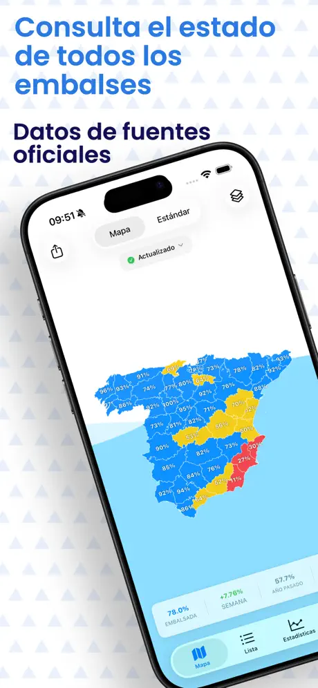
Choropleth Map
Vector layers of Autonomous Communities and Provinces color-coded by water capacity.
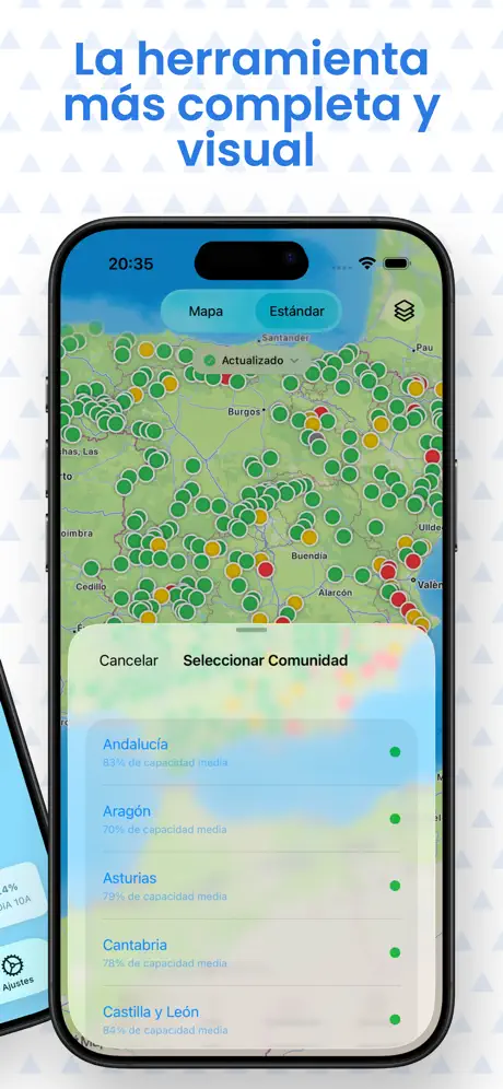
MapKit Satellite
Geographic pinpoints on Apple Maps with standard and satellite styles and favorite filters.
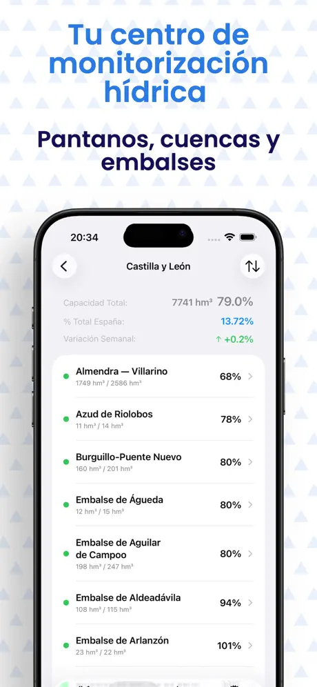
Search & Filters
Real-time search and grouping by River Basin, Autonomous Community, or Province.
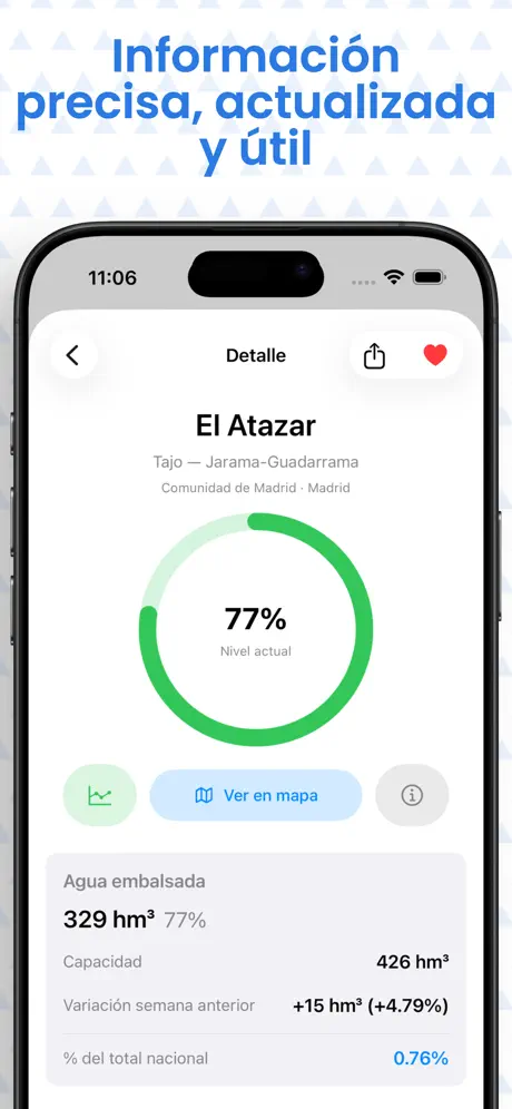
Reservoir Sheets
Current volume (hm³), total capacity, weekly change, and national capacity share.
Weekly Curves
53-week evolution chart of the current year compared to the previous year and 10-year baseline.
iOS Widgets
Home screen widgets: Small (single reservoir), Medium (list), and Regional (national, regional, or provincial).
Scheduled Alerts
Weekly Tuesday bulletin at 20:00, favorite change notices, and provincial threshold alerts.
Share Cards
Generate high-resolution visual infographics of individual dams or Spain's total to share or save.
Changelog
Official update history of the application.
Version 1.0.2
Recent- Fixed a data reading issue with Basque Country reservoirs
- Improved national total percentage calculation
- Prepared for accurate data display starting in 2027
- Minor statistical refinements and adjustments
- Adapted for iPhone Duo
Version 1.0
Initial Release- Initial App Store launch.
- Reservoir and river basin levels based on official weekly data from Spain.
- Interactive choropleth map and 10-year historical baseline comparison.
- Integration with iOS widgets and Siri shortcuts.
Frequently asked questions
Direct answers about the app and data.
Where does reservoir data come from?
All data is retrieved from official public bodies: the Ministry for Ecological Transition (MITECO) and the Automated Hydrological Information Systems (SAIH) of the river basin authorities (Ebro, Duero, Tajo, Guadiana, Guadalquivir, Segura, Júcar, Miño-Sil, Cantábrico, and regional districts).
How frequently are water levels updated?
Official bulletins are published weekly on Tuesdays. The app updates records as public agencies publish new measurements and allows manual pull-to-refresh at any time.
Does the app work offline?
Yes. All queried information is cached on device, and an offline reference database is included to view recent numbers when cellular coverage is unavailable.
What does the free version include vs. the Pro upgrade?
The free download includes the interactive map, complete reservoir directory, search tools, individual reservoir sheets, and national statistics. The Pro upgrade (€1.99 lifetime, one-time payment) unlocks home screen widgets, scheduled notifications, and detailed historical charts.
What data does the application collect?
I do not collect data through Embalses España.
Which Apple devices are supported?
It is compatible with iPhone and iPad (iOS/iPadOS 17.0+), Mac computers with Apple Silicon (macOS 14.0+), and Apple Vision Pro (visionOS 1.0+).